From coastline to countryside, the Isle of Man is blessed with the most beautiful landscapes to explore, whether you’re looking for a gentle amble or a rewarding hike. Bedecked with peaceful glens, hidden coves, rugged mountains and heather-topped moorland, there’s a surprising mix of terrains to explore.
There’s a huge selection of fabulous footpaths and tantalising trails to choose from on the Isle of Man, but for those seeking breathtaking views along the way, we’ve selected some walks that we think have the most spellbinding scenery to feast your eyes on.
Port St Mary to Port Erin
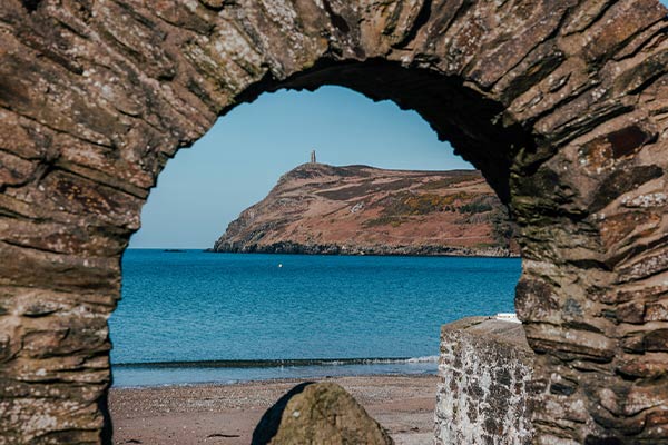
This 7-mile stretch takes in the south coast, starting at the idyllic fishing village of Port St Mary. The walk will see you passing the fossilised tree stumps at Kallow Point, the mysterious Chasms, the nesting site of the Sugarloaf Rock where you’ll spot razorbills, guillemots, and kittiwakes, and the crofting village of Cregneash (well worth stopping to take a look around). You then follow the cliffs, with their spectacular views out to sea (keep an eye out for seals, basking sharks, and dolphins), as you approach the Calf of Man, which is now a nature reserve and bird observatory, and one of the most captivating attractions on the island.
Pause for a moment of rest in the spellbinding Sound Café as you bask in the exceptional views, before following the gorse and heather-lined path west towards Port Erin, perhaps glimpsing the distant Mountains of Mourne if it’s a clear day. On arrival in Port Erin, you can either catch the (seasonal) Steam Railway back to Port Mary or the bus, should you prefer not to walk back. Framed by towering headlands and a pretty harbour, Port Erin is one of the best places for wild swimming on the Isle of Man, promising a blissful way to refresh after your walk.
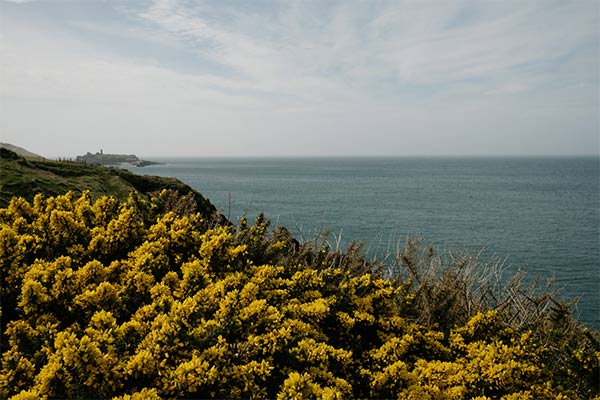
Laxey to Douglas
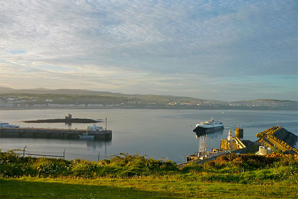
This moderate route snakes along the coast for 9.5 miles, starting at Laxey Promenade before heading south. You’ll find yourself walking down to the beautifully isolated Garwick Bay before weaving your way through Ballanette Reserve – the perfect spot to take a moment of repose as you keep an eye out for meandering wildlife. The reserve also has winsome views of Snaefell in the distance.
Further along the trail, you’ll come across pretty St Adamnan’s, an ancient chapel that still boasts its original 10th-century decorated cross. Moving on, you’ll walk through Groudle Glen and on to Onchan Head, which has gorgeous views over Douglas Bay, before passing through Port Jack and on to Douglas Promenade, where your walk ends. Here, make sure to pop into the Manx Electric Railway station and take time to gaze at the beautiful Victorian and early 20th-century hotels and guesthouses that line the waterfront.
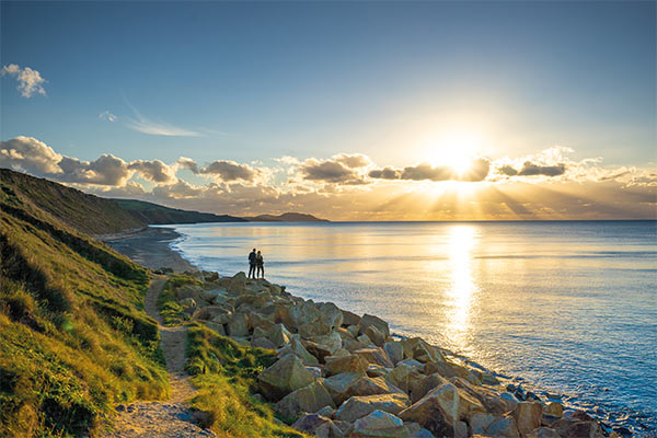
Point of Ayre to Ramsey
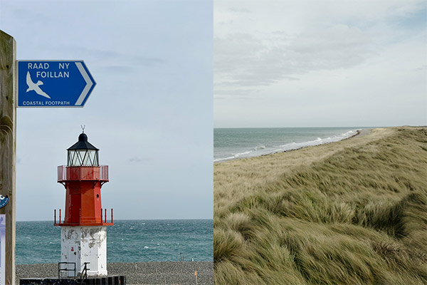
This leisurely 5.5-mile walk is wonderfully family-friendly and takes place almost entirely on the beach, so waiting for low tide is a salt-kissed must. Starting at Point of Ayre Lighthouse, the path leads you across sand and shingle beaches and alongside the striking sand cliffs of Bride and Shellag Point, which were created thousands of years ago by glaciers during the ice age. As you pass them (from a safe distance), you’ll notice the incredible patterns built up over the centuries, while beneath your feet, you’ll find stones carried over the seas from the rest of the British Isles.
Take your time on this charming beach stroll as Maughold Head, North Barrule, and Ramsey come into view, soaking up the coastal scenes as you go. The walk ends at Ramsey’s North Promenade, inviting you to have a look around the harbour, town, and Mooragh Park before getting a bite to eat.
Maughold, Port Mooar, and Port e Vullen
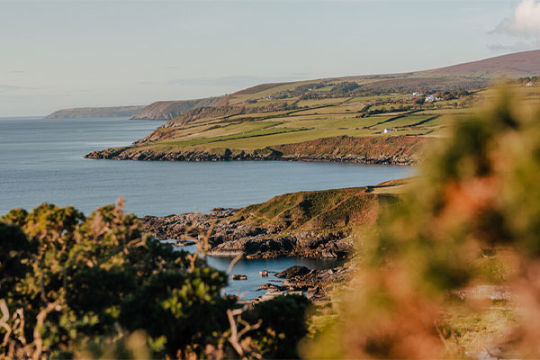
This 4.5-mile circular walk starts and ends at Port Lewaigue car park and takes in the north of the island, offering incredible views of the Maughold Brooghs, a mountain summit that’s protected and a haven for birdlife and wildflowers, including orchids. You begin by walking along the beach at Port e Vullen (you can check local tide times to make sure you avoid high tide). Along the way, you’ll uncover St Maughold Church, where the island’s largest collection of Celtic and Viking crosses resides (including one of the earliest known examples of the Triskellion, the Manx emblem of three legs).
The route also follows a section of the Raad ny Foillan, so you’re guaranteed a dose of vitamin sea as you pass hidden coves (such as secluded Port Mooar), before slowly winding your way inland along flower-flecked country lanes through pretty Maughold with the summit of North Barrule in the distance.
Snaefell to Ramsey
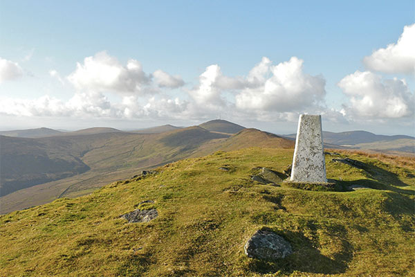
This tough but oh-so-rewarding walk begins with a hike up Snaefell Mountain, the Isle of Man’s highest point at 2,034 feet above sea level. Alternatively, you can begin your journey with a scenic ride on the Snaefell Mountain Railway. Once at the top, you’ll have views over the Isle of Man, England, Scotland, Ireland and Wales on a clear day. From the summit, descend via Clagh Ouyr and North Barrule with incredible views of Ramsey Bay, passing beautiful Ballure Reservoir and Glen as you go.
Finally, the last stretch leads down to Ramsey Beach, where you can dip your toes in the sea before taking a turn around the coastal town to find a pub, café or restaurant for a winsome repast. Make time to potter in the charming collection of independent shops before hopping onto the seasonal Manx Electric Railway back to Douglas.
Glen Mooar and Glen Wyllin
This scenic 4-mile trail starts and ends in Glen Wyllin Campsite car park, boasting lots of fascinating things to see as you go. First, stroll through Glen Wyllin as you follow the dismantled Victorian railway line amongst the trees towards Glen Mooar, where you can bask in the beauty of Spooyt Vane waterfall (which means ‘White Sprout’ in Manx), one of the tallest to be found on the Isle of Man. You’ll also find the remains of an 8th or 9th-century chapel dedicated to St Patrick, complete with a burial ground and a priest’s cell.
After this, take the small diversion to have a look around Cooil Dharry Nature Reserve, owned and managed by the Manx Wildlife Trust, where you can walk alongside a river that’s particularly pretty in spring, when the floor is carpeted in bluebells, primroses, and other spring flowers, before winding your way back to Glen Wyllin and the car park.
Central East Summits
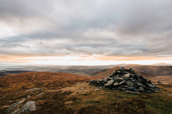
This hike is one for seasoned walkers, as it takes in four summits (each over 1,000 feet) across 10 miles. With breathtaking views of the east coast of the island and the Glen Roy Valley, this walk invites you to climb local favourite Beinn-y-Phott (Penny Pot), as well as a stretch of the Millennium Way, passing St Luke’s Church (believed to be the highest church on the island) as you go. If you pause by the church’s door, it’s said you can see as far as Anglesey.
On this walk you’ll also pass the impressive Killabane Stone Circle, where the Manx parliament took place from the 15th century. Follow a waterside path alongside the Baldwin before traversing moorland to the ascent of Slieau Lhost, where you can bask in the captivating views over Douglas before climbing Slieau Ree to finish. Make sure to plan ahead for this challenging walk, as there are some very strenuous stretches as well as changeable weather.
Santon Station, Glen Grenaugh, Port Grenaugh and Santon Head
This is a leisurely 6.75-mile walk that takes in both the countryside and the coast, which starts and finishes at Santon Station – just jump on the steam train from Douglas or Port Erin and alight at Santon. A particularly lovely walk in spring, it takes in the peaceful cove at Port Grenaugh before heading inland through a sun-dappled glen that comes alive with a carpet of daffodils.
After the secluded woodland, you’ll emerge onto the Read Ny Foillan and take in the beautiful coastal scenery, passing Cronk ny Merriu, a Celtic Iron Age promontory fort, as you go. Any budding bird watchers should remember to take their binoculars with them as this is a great spot for sea birds, including choughs and cormorants, as you make your way towards Stanton Head and back towards Port Grenaugh along the cliffs, before ending your walk back at Santon Station.
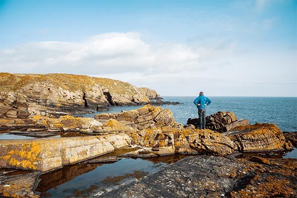
Raad ny Foillan coastal footpath
Meaning ‘The Way of the Gull’ in Manx Gaelic, the Raad ny Foillan is the Isle of Man’s coastal path. Almost 100 miles in length, it’s a walker's delight and offers spectacular scenery all the way around, from craggy clifftops and peaceful sandy beaches to dappled woods and tranquil farmland. While some might love the challenge of walking the whole thing, there are some spellbinding sections to enjoy one by one for the most scenic experience.
Eager to uncover the island’s winding trails? Explore our collection of beautiful holiday cottages on the Isle of Man and start planning your next Manx adventure.